Spatial Indexes
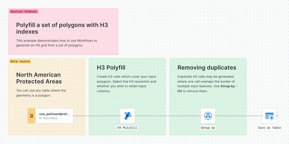
Polyfill a set of polygons with H3 indexes
CARTO DW | BigQuery | Snowflake | Redshift | PostgreSQL |
---|---|---|---|---|
This example demonstrates how to use Workflows to generate an H3 grid from a set of polygons.
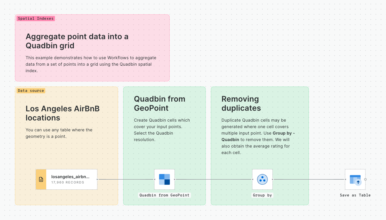
Aggregate point data into a Quadbin grid
CARTO DW | BigQuery | Snowflake | Redshift | PostgreSQL |
---|---|---|---|---|
This example demonstrates how to use Workflows to aggregate data from a set of points into a grid using the Quadbin spatial index.
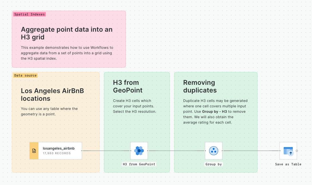
Aggregate point data into an H3 grid
CARTO DW | BigQuery | Snowflake | Redshift | PostgreSQL |
---|---|---|---|---|
This example demonstrates how to use Workflows to aggregate data from a set of points into a grid using the H3 spatial index.
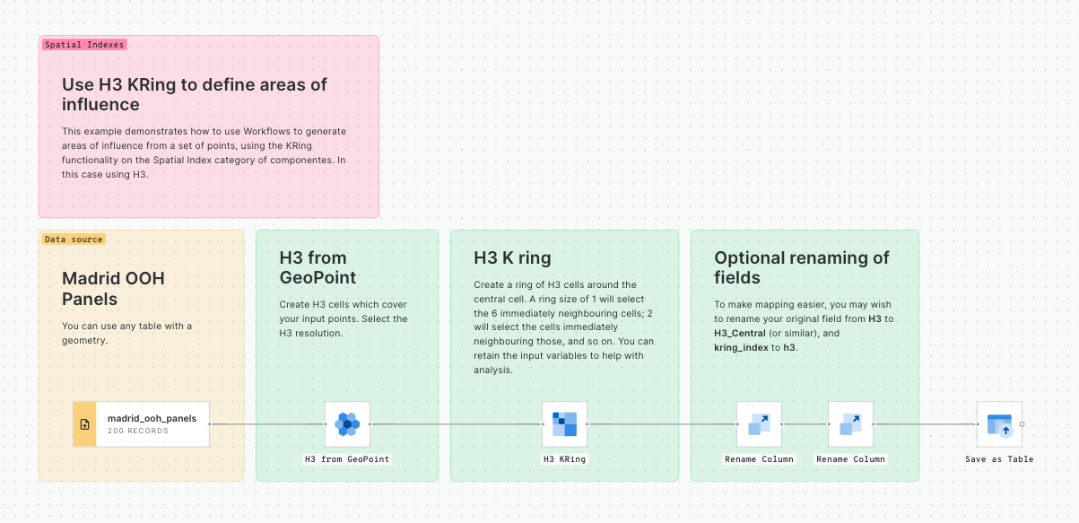
Use H3 KRings to define areas of influence
CARTO DW | BigQuery | Snowflake | Redshift | PostgreSQL |
---|---|---|---|---|
This example demonstrates how to use Workflows to generate areas of influence from a set of points, using the KRing functionality on the Spatial Index category of componentes. In this case using H3.
Last updated