Telco
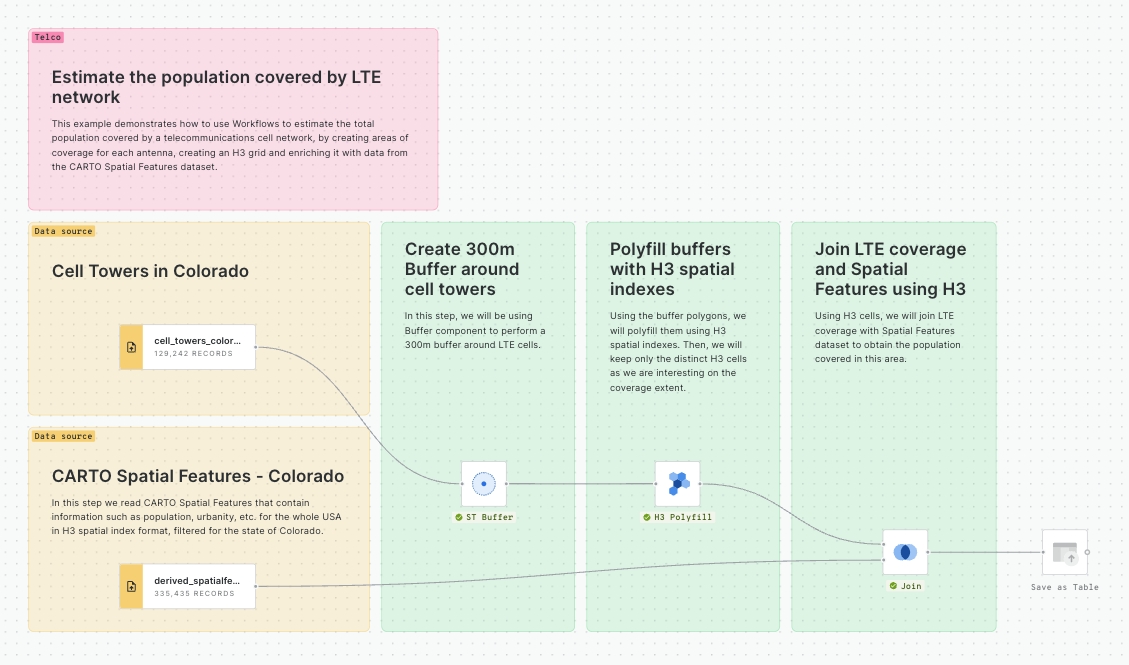
Estimate population covered by a telecommunications cell network
This example demonstrates how to use Workflows to estimate the total population covered by a telecommunications cell network, by creating areas of coverage for each antenna, creating an H3 grid and enriching it with data from the CARTO Spatial Features dataset.
✅
✅
✅
❌
✅

Mobile pings within Area of Interest
This example demonstrates how to use Workflows to find which mobile devices are close to a set of specific locations, in this case, supermarkets of competing brands.
✅
✅
✅
✅
✅

Population Statistics
This example demonstrates how to use Workflows to carry on with a common analysis for telco providers: analyze their coverage both by area (i.e. square kilometers) and by population covered.
In this analysis we will analyze the coverage for AT&T LTE Voice based on the public data from the Federal Communications Commission FCC.
✅
✅
✅
✅
✅

Emergency Response
This example demonstrates how to use Workflows to leverage Telco providers' advanced capabilities to respond to natural disasters. Providers can use geospatial data to better detect at risk areas for specific storms. In this analysis we will analyze buildings and cell towers in New Orleans to find clusters of at risk buildings for flooding and potential outages.
✅
✅
❌
❌
❌

New tower site selection in Denver
Selecting a new location for a tower requires understanding where customers and coverage gaps are, however, we can also identify buildings that might be suitable for a new tower. We do that in this analysis.
✅
✅
✅
✅
✅

Competitor's coverage analysis
This example shows how a telco provider could use Workflows to identify areas where they don't have 5G coverage while their competitors do.
Later, adding some socio-demographic variables to these areas would help them prioritize and plan for network expansion.
✅
✅
✅
❌
✅

Path profile and path loss analysis
For this template, you will need to install the Telco Signal Propagation Models extension package.
This template acts as a guide to perform path loss and path profile analysis for an area of interest. This template uses vector data of clutter for the analysis.
Read the full guide to learn more.
✅
✅
❌
❌
❌

Path profile and path loss analysis with raster sources
For this template, you will need to install the Telco Signal Propagation Models extension package.
This template acts as a guide to perform path loss and path profile analysis for an area of interest. This template uses raster data of clutter for the analysis.
Read the full guide to learn more.
✅
✅
❌
❌
❌

Last updated
Was this helpful?

